row, row, row my boat
Jul. 26th, 2010 05:40 pmWe had so much fun on the San Juan trip from Montezuma Creek to Mexican Hat we did in June that we had to do it again. Britt got on the BLM's website to check cancellations, and found a date on which we could get a permit from Sand Island all the way to Clay Hills Crossing, another ~55 miles past Mexican Hat.

(A lot of people cancelled July trips due to the unusually low river flows and hot weather; these things, of course, made us a bit nervous as well, but since we had small boats as opposed to big rafts, we figured we could handle the former, and as to the latter, that's what a river's for.)
With such short notice we were only able to rustle up one other couple to come with us - Dave and Julie, who rented a canoe for the trip. Dave is experienced but although Julie had tried whitewater kayaking some time ago ("I sucked at it! I swam every single rapid! It was terrifying!") she'd never paddled a canoe or even been on a multi-day river trip. I had my oar frame, since oars are more powerful than a paddle, and we'd have to load our boats with more gear since we didn't have any big rafts with us. We'd bought a fancy new cooler which we hoped would keep things cold for at least the first four days in the predicted 100°-plus heat, and that went on my boat along with half of the unrefrigerated food, my clothes, extra drinks, some of our camp gear, and our portable toilet; we filled our older cheap cooler with beer, soda, and ice, since the river would be too warm to cool our drinks more than a little, and put it on Britt's boat with the bulk of our camping and cooking gear. We split the dinner food and cooking duties with Dave and Julie, and did our own breakfasts, lunch, and drinks.

Day 1
Early in the morning we drove out to Sand Island. The ranger there told us that we'd need to get a different bucket for our, er, human waste, as the one we'd bought on the previous ranger's say-so didn't have a screw-on lid; fortunately he also told us that one of the resorts in Bluff would give us a proper bucket, one that their pool chemicals had come in, and Jim, our shuttle driver, had no problem in stopping there while we moved our vehicles to his lot. The ranger also mentioned that he'd had to go in to rescue a wrapped canoe in Government Rapid, the worst rapid at these levels, which information did not thrill Julie and Dave. There were two other groups at the put-in; a group of rafts, which we passed just after lunch and never saw again until the take-out, and a couple of women in duckies (inflatable kayaks) who we saw twice.
We stopped at the wonderful petroglyph panels at Butler Wash, which we had only seen from the river before, and then had lunch at Desecration as we did on the previous trip. Shortly after, we entered the canyon and the riffles and rapids began. The first day had only one named rapid, Four Foot Rapid, but at this low water level several of the riffles (places where the current sped up over rocks or at river bends) were more challenging than they were on our earlier trip. One became a river-wide ledge with a clear tongue making a curve on far river right, nearly worthy of the designation of rapid. I called it "Goose Ledge Rapid" because a large flock of Canada geese hung out there.
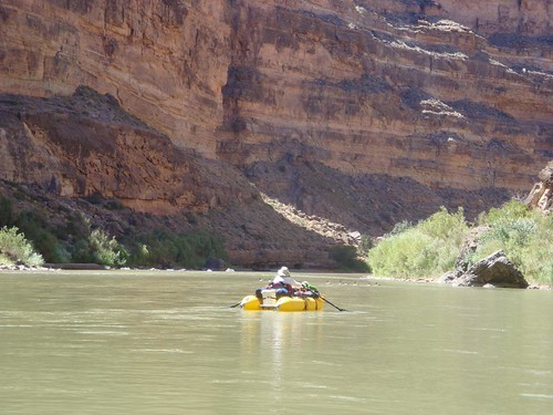
(A different set of geese)
We had wanted to stop at Midway, where we'd camped before, but the duckie girls were there, so we continued on another half mile and found a decent beach for camping. Unfortunately, the entire beach was crawling with tiny ants. Dave and Julie slept outside and got swarmed upon; we put up our tent, although not the rain fly, and woke to find it thick with the little buggers. (Later we talked to the duckie girls and a family who had camped just below where we were, and found that they, too, had ant-infested camps. Fortunately we never saw them in quantity again; we are guessing that maybe it was something about the place and the season.)
Day 2
I had been nervous about Eight Foot Rapid, which had dumped me out of my boat on the previous trip, and which was just a couple of miles beyond our campsite. It turned out to be a bit easier at this lower water level, or maybe it was just that I entered the rapid in a better place, without having a big raft in front of me blocking my view. The canoe had to do some bailing, but we all made it through with no problem. It was followed by Ledge Rapid, and again the canoe had to stop and bail afterward.
The previous day's geese were a harbinger of the incredible wildlife we saw on this trip. On day 2 we saw two desert bighorn nearly at the water's edge on the right side of the river, calmly watching us go by. A bit farther on, we saw a whole herd of them on the left. (All the subsequent bighorn were on the left, on Navajo land. I guess they were Navajo sheep!) In general, the bighorn seemed quite blase about the presence of river runners. Then Julie and Dave spotted two beavers under a riverside ledge. They stared nervously at us until we had floated on, probably feeling quite trapped.

We came out of the canyon at Mexican Hat, but this time continued past the take-out where local families frolicked in the slow-moving water. The weather was very hot, well over 100°F and sunny, and the water, though warm, was at least cooler than that. We certainly spent a lot of time in the water ourselves, floating alongside our boats. We also had made sure to bring lightweight, light-colored long clothes to keep the sun off, as well as plenty of sunscreen.
Just past the take-out was Gypsum Creek Rapid, which was described in the guidebook as "rocky" - and boy, was it ever. Britt went through first, with me following, and we had to maneuver quite a bit to keep from bumping rocks in the large, shallow pool above the tongue of the actual rapid. Fortunately, the oar rigs are very maneuverable and as the power stroke involves pulling backwards, it kept things nice and slow as we edged toward the tongue, which took us between large rocks and waves. At the end there was a big rock to avoid, along with a huge irregular diagonal wave that we both managed to mostly avoid - but when we got to the bottom, we eddied out and looked at each other with the same thought: that canoe is going to have a hard time not hitting that wave.
And it did. They took on water in the top of the rapid and so couldn't maneuver well enough to avoid getting entirely swamped by the big diagonal wave. The canoe was essentially filled with water, and it was like watching a slo-mo video as it gently tipped over and Dave and Julie jumped out to avoid a complete capsize. Britt and I rowed out to rescue the floating paddles, water bottles, and odd cantalope (the people were able to wade to a beach, and Dave had a hold on the canoe), but they lost their lawn chairs, which hadn't been tied down well enough and which sank before we could get to them.
Just past Gypsum Creek Rapid we passed under the Mexican Hat bridge, then pulled off under the little restaurant/hotel/gift shop there to buy more ice. We frequently stop at the restaurant while in the area, not because the food there is particularly good but because it is perched on a cliff above the river, with wonderful views. As we hiked the long uphill path to the restaurant, the temperature climbed as much as we did. We raced back downhill to put the ice in our coolers before it melted.
We camped on a beach on the Mendenhall Loop, which we chose mostly because it was already in the shade. Even so, when we pulled out Britt's altimeter watch, which has a thermometer, the temperature reading slowly increased to 103°F - at 7pm! At least we had cold beer in the coolers, and an ant-free beach. Unfortunately, Britt and I made the tactical error of spreading our sleeping pads (we decided to forgo the tent) on a rock ledge, thinking that it would be cleaner than the sand beach. We forgot that rock retains heat very well; in the wee hours, we woke, sweating, and prudently moved our bed the ten feet to the beach, where it was far cooler and we slept much better.
Day 3
The Mendenhall Loop marks the beginning of the Goosenecks - river loops which curve back on themselves such that it takes 1-3 river miles to travel 1/4 mile over land. We got going early enough that we could get to the other side of the narrow ridge behind our camp while it was still relatively cool, so we could hike to the Mendenhall cabin - ruins of a prospector's camp - in the notch.

It was another scorcher of a day, though, and we probably spent more time in the river than in our boats, easy because there were no rapids and only fairly minor riffles, with long stretches of flat water. We saw more wildlife today, including a deer, which was much spookier than the bighorn and immediately bounded off into the bushes where it could peer at us from a safe hiding place as we went by.
We went past a big camp with a lovely beach, through a small riffle, and pulled over at the next camp, as it was directly under the start of the Honaker trail, where we planned hiking the next morning. This camp, though, was not nearly as nice as the first, and Dave and Julie persuaded us to pull our boats back upstream. Which turned out to be more doable than I had expected, wading through the knee-to-hip-deep water pulling the boats against the current, although we were all covered in sweat by the time we got back to the beach and had to go for a swim.
For dinner we had gazpacho, which I had made at home and frozen solid before packing. That morning I had taken it (still partly frozen) from the good cooler, added extra cut-up veggies, and put the bottle into the beer cooler; when we took it out that evening it was perfect, cold but not frozen, a great meal with cheese and crackers on a ridiculously hot desert night. I should add that we were drinking cold gin and tonics as well, with ice and lime. So very decadent!
Day 4
In the morning the camp was nice and shady for our hike up the Honaker Trail. This trail, originally made for prospectors' mules, leads all the way to the rim 1200 ft up, to a road that takes off from the John's Canyon road (where we camped in May and got caught in a snowstorm). We only went as far as a spectacular overlook, but it was still a hefty climb, taking us an hour to get to the top and nearly as long to get back down as the trail switchbacks long distances across the various rock levels until it can break through each cliff band in turn.

Because of our hike, we got on the river fairly late in the morning. We needed to cover ground, though, so we floated for a while before finding a nice, shady lunch spot on some ledges. We went through a number of riffles, and then Ross Rapid, another relatively easy rapid which still had enough big waves to make the canoe look like a submarine. Actually, the toughest boating challenge of the day came just before camp, when we went through a rock garden that filled the river from shore to shore. Each of us picked a different line, but none of us made it through without bumping into numerous rocks. I bet it would have been even more challenging in a larger raft.

We took the upper John's Canyon camp as we knew there was a group ahead of us and we suspected (and later confirmed) they had the lower camp. But it turned out that this choice had a wonderful consequence - a small family of bighorn sheep (ram, ewe, and two lambs) decided to hang out directly across the river from us all afternoon, frolicking among the rocks, nibbling on the greenery, drinking from the river and ultimately bedding down for the night. Britt had brought binoculars so we traded them around during our cocktail hour and dinner, watching their antics. The ram asserted his authority mostly by head-butting the others; the young sheep bounced around excitedly, and the two adults took turns watching the kids while the other went for a snack. It was really cool.

Day 5
After breakfast, we packed up our boats and rowed through the riffle separating us from the lower camp. The other group was just getting ready to head out. We pulled in just below their camp in order to hike up to the swimming hole above the pourover at the mouth of John's Canyon. The night before we had walked to the below the pourover, which was currently dry but which occasionally runs when there is rain upcanyon (there's a wonderful photo in the guidebook of a flash flood waterfall). It didn't look like there was a way up at all. And in fact the way up required a long switchbacking hike and a couple of short but scary rock-climbing sections, one up to a higher cliff layer and the other down to the rock layer above the pourover - but it was worth it! The swimming hole is a deep pool in the limestone, deep, clear, and cool, and we all high-jumped in and swam around delightedly. Out on the rock we found fossils from when this part of the canyon had been the floor of a prehistoric sea.


All the splashing in the world couldn't distract me from what I knew lay ahead just a few miles down the river: Government Rapid. This is the final and hardest rapid on the river, and according to the guidebook it is "tricky at low water," so I was a bit apprehensive. The rumble ahead as we approached only heightened my nervousness. And when we pulled over at the camp just above it to walk down and scout it, well - I gulped hard.
Rocks. Lots of big pointy rocks, with big tongues of water between them, and big waves splashing up onto them. It was clear that the primary danger was getting shoved up onto a rock by the current. Britt and I talked through the path that we would need to follow to be safe. Dave took one look and said, "We can't do this in a canoe, but it looks like we can walk it through the upper part and sneak the lower on the far right" - and that is what they did, beautifully. (You can see a sequence of photos showing them doing this here.) Unfortunately, the rocks they lined their canoe through were too close together for me to do the same with my cataraft. Oh, well - I watched Britt navigate expertly through the rapid, and then it was my turn.
I went in as close as I could to the marker rock at the top that we'd identified, then pulled away to slide over the small drop between two nasty rocks - so far, so good. At the bottom, I ended up going up against a rock, but it wasn't one of the dangerous ones as it was covered with a nice pillow of rushing water, and I pivoted around to bounce off the water cushion and slid right down the second tongue. Okay, I slid down it backwards - but who cares? I made it!


We camped at Slickhorn Canyon, another side canyon with terrific pools, although on this visit the pools were smaller and less clear than we remembered them. Also, it had been cloudy all day, and it began to drizzle as we hiked, so they were less inviting. But worst of all, I slipped on a rock and fell such that my right hand went smack into a prickly pear cactus. If you have never slammed the palm of your hand into a cactus, I sincerely do not recommend it. First it hurt. Then it burned. Then it hurt some more. Fortunately Britt had tweezers with him, but it took several days before I got most of the spines out - and I still have ominous red spots on my hand that I suspect will soon erupt bits of cactus spine.
Day 6
There used to be a rapid at Slickhorn, but Lake Powell's high water level of 1983-84 drowned it. Not only that, it deposited enough silt in the river channel that the entire character of the river below Slickhorn has changed. Instead of a gradient of 6-10 feet per mile, the gradient is only 6 inches per mile. The river stretches mostly from wall to wall, sluggish and silty, and at low water sandbars lurk, forcing travelers to cross and recross the river, tracing the S-curve of deeper water. (Not that "deeper" means particularly deep. Rarely was it above our waists when we jumped in.)
It had rained during the previous evening and it rained a bit during the morning as well, with the result that when we arrived at Grand Gulch, small, muddy waterfalls were pouring out of the canyon where normally there is only a trickle. We had lunch and then took a long hike up the canyon as the weather cleared. By the time we got in the boats again, the sky was mostly blue.


After lunch we continued to Oljeto Wash, where we would be camping. (Campsites for the area below Government Rapids are assigned with the permit, because there are so few of them in the silted section.) We hiked our stuff across the large and low damp sand beach to the slightly higher and drier area with the tamarisk. Tamarisk are a non-native plant which has crowded out the native vegetation on the banks of most SW rivers. On the San Juan, though, they are dying out due to a deliberate release a few years ago of tamarisk beetles, which eat the leaves and kill the trees. Here at the Oljeto camp we saw not only the tiny green beetles, which we had seen at other spots along the river, but also their larvae which covered the branches and leaves here.
We had set up the kitchen of our camp and were chatting over drinks (the last of the liquor, mixed with whatever we had, no ice) when suddenly Britt shushed everyone. "Do you hear that?" We listened. A low rumble was coming from the canyon mouth behind us.
We all jumped to our feet and moved to the edge of the thin stream that trickled out of the wash. The rumble was clearly coming from upstream, and getting louder all the time. It was a classic flash flood - despite the clear weather at the river, it had rained hard earlier somewhere in the plateaus above, and all that water had been rushing down the various side canyons and gathering in Oljeto Wash and was finally on its way to us. Apprehensively we peered at the curved wall, the farthest upstream point we could see, and wondered how big the flood would be.
Fortunately, no six-foot wall of water came hurtling down the wash. It was only a small wave front, but behind it the stream expanded in a thick ribbon of what looked like tomato soup, widening by the minute. Nervously we moved our camp to somewhat higher ground, and then returned (drinks in hand, of course!) to watch the water spread.


Little by little, the wide sand delta at the canyon's mouth was first covered, then eaten away by the muddy water. Deeper channels and waterfalls formed, and pretty soon there was a very nice little chute that looked like a perfect canoe slot. "You ought to run that canoe down here," I said to Dave. "The first descent of Oljeto Falls."
So he did. Julie prudently decided to join me as expedition photographer, so Britt took the front seat. They paddled up to near the first curve, then turned downstream and shot the "rapid" - which disintegrated fifteen minutes later as the sand ledges collapsed.


Day 7
In the morning the waters had receded for the most part, although it was still thick enough with mud to coat our feet and color the green waters of the San Juan a reddish-brown. We hiked up Oljeto Wash, a really beautiful canyon with huge overhangs, before returning to camp for breakfast. Then we packed up and headed downstream, arriving at the take-out in the early afternoon. Bye-bye, San Juan!


These are only a few (I know!) of the 55 photos I uploaded to my Flickr set for this trip.
(A lot of people cancelled July trips due to the unusually low river flows and hot weather; these things, of course, made us a bit nervous as well, but since we had small boats as opposed to big rafts, we figured we could handle the former, and as to the latter, that's what a river's for.)
With such short notice we were only able to rustle up one other couple to come with us - Dave and Julie, who rented a canoe for the trip. Dave is experienced but although Julie had tried whitewater kayaking some time ago ("I sucked at it! I swam every single rapid! It was terrifying!") she'd never paddled a canoe or even been on a multi-day river trip. I had my oar frame, since oars are more powerful than a paddle, and we'd have to load our boats with more gear since we didn't have any big rafts with us. We'd bought a fancy new cooler which we hoped would keep things cold for at least the first four days in the predicted 100°-plus heat, and that went on my boat along with half of the unrefrigerated food, my clothes, extra drinks, some of our camp gear, and our portable toilet; we filled our older cheap cooler with beer, soda, and ice, since the river would be too warm to cool our drinks more than a little, and put it on Britt's boat with the bulk of our camping and cooking gear. We split the dinner food and cooking duties with Dave and Julie, and did our own breakfasts, lunch, and drinks.
Day 1
Early in the morning we drove out to Sand Island. The ranger there told us that we'd need to get a different bucket for our, er, human waste, as the one we'd bought on the previous ranger's say-so didn't have a screw-on lid; fortunately he also told us that one of the resorts in Bluff would give us a proper bucket, one that their pool chemicals had come in, and Jim, our shuttle driver, had no problem in stopping there while we moved our vehicles to his lot. The ranger also mentioned that he'd had to go in to rescue a wrapped canoe in Government Rapid, the worst rapid at these levels, which information did not thrill Julie and Dave. There were two other groups at the put-in; a group of rafts, which we passed just after lunch and never saw again until the take-out, and a couple of women in duckies (inflatable kayaks) who we saw twice.
We stopped at the wonderful petroglyph panels at Butler Wash, which we had only seen from the river before, and then had lunch at Desecration as we did on the previous trip. Shortly after, we entered the canyon and the riffles and rapids began. The first day had only one named rapid, Four Foot Rapid, but at this low water level several of the riffles (places where the current sped up over rocks or at river bends) were more challenging than they were on our earlier trip. One became a river-wide ledge with a clear tongue making a curve on far river right, nearly worthy of the designation of rapid. I called it "Goose Ledge Rapid" because a large flock of Canada geese hung out there.
(A different set of geese)
We had wanted to stop at Midway, where we'd camped before, but the duckie girls were there, so we continued on another half mile and found a decent beach for camping. Unfortunately, the entire beach was crawling with tiny ants. Dave and Julie slept outside and got swarmed upon; we put up our tent, although not the rain fly, and woke to find it thick with the little buggers. (Later we talked to the duckie girls and a family who had camped just below where we were, and found that they, too, had ant-infested camps. Fortunately we never saw them in quantity again; we are guessing that maybe it was something about the place and the season.)
Day 2
I had been nervous about Eight Foot Rapid, which had dumped me out of my boat on the previous trip, and which was just a couple of miles beyond our campsite. It turned out to be a bit easier at this lower water level, or maybe it was just that I entered the rapid in a better place, without having a big raft in front of me blocking my view. The canoe had to do some bailing, but we all made it through with no problem. It was followed by Ledge Rapid, and again the canoe had to stop and bail afterward.
The previous day's geese were a harbinger of the incredible wildlife we saw on this trip. On day 2 we saw two desert bighorn nearly at the water's edge on the right side of the river, calmly watching us go by. A bit farther on, we saw a whole herd of them on the left. (All the subsequent bighorn were on the left, on Navajo land. I guess they were Navajo sheep!) In general, the bighorn seemed quite blase about the presence of river runners. Then Julie and Dave spotted two beavers under a riverside ledge. They stared nervously at us until we had floated on, probably feeling quite trapped.
We came out of the canyon at Mexican Hat, but this time continued past the take-out where local families frolicked in the slow-moving water. The weather was very hot, well over 100°F and sunny, and the water, though warm, was at least cooler than that. We certainly spent a lot of time in the water ourselves, floating alongside our boats. We also had made sure to bring lightweight, light-colored long clothes to keep the sun off, as well as plenty of sunscreen.
Just past the take-out was Gypsum Creek Rapid, which was described in the guidebook as "rocky" - and boy, was it ever. Britt went through first, with me following, and we had to maneuver quite a bit to keep from bumping rocks in the large, shallow pool above the tongue of the actual rapid. Fortunately, the oar rigs are very maneuverable and as the power stroke involves pulling backwards, it kept things nice and slow as we edged toward the tongue, which took us between large rocks and waves. At the end there was a big rock to avoid, along with a huge irregular diagonal wave that we both managed to mostly avoid - but when we got to the bottom, we eddied out and looked at each other with the same thought: that canoe is going to have a hard time not hitting that wave.
And it did. They took on water in the top of the rapid and so couldn't maneuver well enough to avoid getting entirely swamped by the big diagonal wave. The canoe was essentially filled with water, and it was like watching a slo-mo video as it gently tipped over and Dave and Julie jumped out to avoid a complete capsize. Britt and I rowed out to rescue the floating paddles, water bottles, and odd cantalope (the people were able to wade to a beach, and Dave had a hold on the canoe), but they lost their lawn chairs, which hadn't been tied down well enough and which sank before we could get to them.
Just past Gypsum Creek Rapid we passed under the Mexican Hat bridge, then pulled off under the little restaurant/hotel/gift shop there to buy more ice. We frequently stop at the restaurant while in the area, not because the food there is particularly good but because it is perched on a cliff above the river, with wonderful views. As we hiked the long uphill path to the restaurant, the temperature climbed as much as we did. We raced back downhill to put the ice in our coolers before it melted.
We camped on a beach on the Mendenhall Loop, which we chose mostly because it was already in the shade. Even so, when we pulled out Britt's altimeter watch, which has a thermometer, the temperature reading slowly increased to 103°F - at 7pm! At least we had cold beer in the coolers, and an ant-free beach. Unfortunately, Britt and I made the tactical error of spreading our sleeping pads (we decided to forgo the tent) on a rock ledge, thinking that it would be cleaner than the sand beach. We forgot that rock retains heat very well; in the wee hours, we woke, sweating, and prudently moved our bed the ten feet to the beach, where it was far cooler and we slept much better.
Day 3
The Mendenhall Loop marks the beginning of the Goosenecks - river loops which curve back on themselves such that it takes 1-3 river miles to travel 1/4 mile over land. We got going early enough that we could get to the other side of the narrow ridge behind our camp while it was still relatively cool, so we could hike to the Mendenhall cabin - ruins of a prospector's camp - in the notch.
It was another scorcher of a day, though, and we probably spent more time in the river than in our boats, easy because there were no rapids and only fairly minor riffles, with long stretches of flat water. We saw more wildlife today, including a deer, which was much spookier than the bighorn and immediately bounded off into the bushes where it could peer at us from a safe hiding place as we went by.
We went past a big camp with a lovely beach, through a small riffle, and pulled over at the next camp, as it was directly under the start of the Honaker trail, where we planned hiking the next morning. This camp, though, was not nearly as nice as the first, and Dave and Julie persuaded us to pull our boats back upstream. Which turned out to be more doable than I had expected, wading through the knee-to-hip-deep water pulling the boats against the current, although we were all covered in sweat by the time we got back to the beach and had to go for a swim.
For dinner we had gazpacho, which I had made at home and frozen solid before packing. That morning I had taken it (still partly frozen) from the good cooler, added extra cut-up veggies, and put the bottle into the beer cooler; when we took it out that evening it was perfect, cold but not frozen, a great meal with cheese and crackers on a ridiculously hot desert night. I should add that we were drinking cold gin and tonics as well, with ice and lime. So very decadent!
Day 4
In the morning the camp was nice and shady for our hike up the Honaker Trail. This trail, originally made for prospectors' mules, leads all the way to the rim 1200 ft up, to a road that takes off from the John's Canyon road (where we camped in May and got caught in a snowstorm). We only went as far as a spectacular overlook, but it was still a hefty climb, taking us an hour to get to the top and nearly as long to get back down as the trail switchbacks long distances across the various rock levels until it can break through each cliff band in turn.
Because of our hike, we got on the river fairly late in the morning. We needed to cover ground, though, so we floated for a while before finding a nice, shady lunch spot on some ledges. We went through a number of riffles, and then Ross Rapid, another relatively easy rapid which still had enough big waves to make the canoe look like a submarine. Actually, the toughest boating challenge of the day came just before camp, when we went through a rock garden that filled the river from shore to shore. Each of us picked a different line, but none of us made it through without bumping into numerous rocks. I bet it would have been even more challenging in a larger raft.
We took the upper John's Canyon camp as we knew there was a group ahead of us and we suspected (and later confirmed) they had the lower camp. But it turned out that this choice had a wonderful consequence - a small family of bighorn sheep (ram, ewe, and two lambs) decided to hang out directly across the river from us all afternoon, frolicking among the rocks, nibbling on the greenery, drinking from the river and ultimately bedding down for the night. Britt had brought binoculars so we traded them around during our cocktail hour and dinner, watching their antics. The ram asserted his authority mostly by head-butting the others; the young sheep bounced around excitedly, and the two adults took turns watching the kids while the other went for a snack. It was really cool.
Day 5
After breakfast, we packed up our boats and rowed through the riffle separating us from the lower camp. The other group was just getting ready to head out. We pulled in just below their camp in order to hike up to the swimming hole above the pourover at the mouth of John's Canyon. The night before we had walked to the below the pourover, which was currently dry but which occasionally runs when there is rain upcanyon (there's a wonderful photo in the guidebook of a flash flood waterfall). It didn't look like there was a way up at all. And in fact the way up required a long switchbacking hike and a couple of short but scary rock-climbing sections, one up to a higher cliff layer and the other down to the rock layer above the pourover - but it was worth it! The swimming hole is a deep pool in the limestone, deep, clear, and cool, and we all high-jumped in and swam around delightedly. Out on the rock we found fossils from when this part of the canyon had been the floor of a prehistoric sea.
All the splashing in the world couldn't distract me from what I knew lay ahead just a few miles down the river: Government Rapid. This is the final and hardest rapid on the river, and according to the guidebook it is "tricky at low water," so I was a bit apprehensive. The rumble ahead as we approached only heightened my nervousness. And when we pulled over at the camp just above it to walk down and scout it, well - I gulped hard.
Rocks. Lots of big pointy rocks, with big tongues of water between them, and big waves splashing up onto them. It was clear that the primary danger was getting shoved up onto a rock by the current. Britt and I talked through the path that we would need to follow to be safe. Dave took one look and said, "We can't do this in a canoe, but it looks like we can walk it through the upper part and sneak the lower on the far right" - and that is what they did, beautifully. (You can see a sequence of photos showing them doing this here.) Unfortunately, the rocks they lined their canoe through were too close together for me to do the same with my cataraft. Oh, well - I watched Britt navigate expertly through the rapid, and then it was my turn.
I went in as close as I could to the marker rock at the top that we'd identified, then pulled away to slide over the small drop between two nasty rocks - so far, so good. At the bottom, I ended up going up against a rock, but it wasn't one of the dangerous ones as it was covered with a nice pillow of rushing water, and I pivoted around to bounce off the water cushion and slid right down the second tongue. Okay, I slid down it backwards - but who cares? I made it!
We camped at Slickhorn Canyon, another side canyon with terrific pools, although on this visit the pools were smaller and less clear than we remembered them. Also, it had been cloudy all day, and it began to drizzle as we hiked, so they were less inviting. But worst of all, I slipped on a rock and fell such that my right hand went smack into a prickly pear cactus. If you have never slammed the palm of your hand into a cactus, I sincerely do not recommend it. First it hurt. Then it burned. Then it hurt some more. Fortunately Britt had tweezers with him, but it took several days before I got most of the spines out - and I still have ominous red spots on my hand that I suspect will soon erupt bits of cactus spine.
Day 6
There used to be a rapid at Slickhorn, but Lake Powell's high water level of 1983-84 drowned it. Not only that, it deposited enough silt in the river channel that the entire character of the river below Slickhorn has changed. Instead of a gradient of 6-10 feet per mile, the gradient is only 6 inches per mile. The river stretches mostly from wall to wall, sluggish and silty, and at low water sandbars lurk, forcing travelers to cross and recross the river, tracing the S-curve of deeper water. (Not that "deeper" means particularly deep. Rarely was it above our waists when we jumped in.)
It had rained during the previous evening and it rained a bit during the morning as well, with the result that when we arrived at Grand Gulch, small, muddy waterfalls were pouring out of the canyon where normally there is only a trickle. We had lunch and then took a long hike up the canyon as the weather cleared. By the time we got in the boats again, the sky was mostly blue.
After lunch we continued to Oljeto Wash, where we would be camping. (Campsites for the area below Government Rapids are assigned with the permit, because there are so few of them in the silted section.) We hiked our stuff across the large and low damp sand beach to the slightly higher and drier area with the tamarisk. Tamarisk are a non-native plant which has crowded out the native vegetation on the banks of most SW rivers. On the San Juan, though, they are dying out due to a deliberate release a few years ago of tamarisk beetles, which eat the leaves and kill the trees. Here at the Oljeto camp we saw not only the tiny green beetles, which we had seen at other spots along the river, but also their larvae which covered the branches and leaves here.
We had set up the kitchen of our camp and were chatting over drinks (the last of the liquor, mixed with whatever we had, no ice) when suddenly Britt shushed everyone. "Do you hear that?" We listened. A low rumble was coming from the canyon mouth behind us.
We all jumped to our feet and moved to the edge of the thin stream that trickled out of the wash. The rumble was clearly coming from upstream, and getting louder all the time. It was a classic flash flood - despite the clear weather at the river, it had rained hard earlier somewhere in the plateaus above, and all that water had been rushing down the various side canyons and gathering in Oljeto Wash and was finally on its way to us. Apprehensively we peered at the curved wall, the farthest upstream point we could see, and wondered how big the flood would be.
Fortunately, no six-foot wall of water came hurtling down the wash. It was only a small wave front, but behind it the stream expanded in a thick ribbon of what looked like tomato soup, widening by the minute. Nervously we moved our camp to somewhat higher ground, and then returned (drinks in hand, of course!) to watch the water spread.
Little by little, the wide sand delta at the canyon's mouth was first covered, then eaten away by the muddy water. Deeper channels and waterfalls formed, and pretty soon there was a very nice little chute that looked like a perfect canoe slot. "You ought to run that canoe down here," I said to Dave. "The first descent of Oljeto Falls."
So he did. Julie prudently decided to join me as expedition photographer, so Britt took the front seat. They paddled up to near the first curve, then turned downstream and shot the "rapid" - which disintegrated fifteen minutes later as the sand ledges collapsed.
Day 7
In the morning the waters had receded for the most part, although it was still thick enough with mud to coat our feet and color the green waters of the San Juan a reddish-brown. We hiked up Oljeto Wash, a really beautiful canyon with huge overhangs, before returning to camp for breakfast. Then we packed up and headed downstream, arriving at the take-out in the early afternoon. Bye-bye, San Juan!
These are only a few (I know!) of the 55 photos I uploaded to my Flickr set for this trip.